We’ve all heard advice on how to use clouds as part of your race strategy. Most of what I’ve heard has been vague – “sail towards the clouds” – and wasn’t backed by a good explanation. So, it was refreshing to read Speed and Smarts Issue #151 about weather, which includes input from Chelsea Carlson. Chelsea is a sailor and professional meteorologist. She advises the U.S. Sailing Team on weather and runs Sea Tactics, a weather resource for racing sailors.
In this post, we’ll summarize Chelsea’s views on cloud strategy. Much of the material can be found in her video Weather Strategy 101, produced for U.S. Sailing. She also graciously contributed the graphics for this post. We recommend you watch the entire video; it’s one of the best weather videos we’ve seen, with practical examples and interactive questions for the audience.
Cloud Strategy: Thought Question
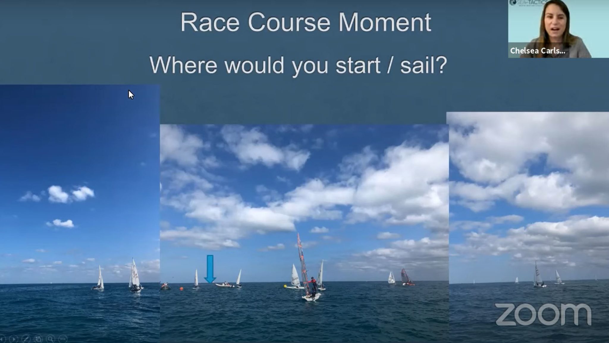
The video starts with a question to ponder. Watch the excerpt at 00:09:29, which shows you pictures of a race course with scattered cloud cover. She asks viewers to think about which side of the course is likely to be better. She doesn’t give the answer right away, and discusses weather basics first. You can either watch the weather basics discussion (recommended) or skip to the sections discussing clouds listed below.
Cloud Significance
At 00:36:13, she discusses the two basic types of clouds that have direct impact on the surface wind. Other types of clouds can signal upcoming changes but don’t affect the surface wind as much.
- Cumulus clouds: clouds with vertical development (puffy) but no rain
- Cumulonimbus clouds: clouds with vertical development and rain
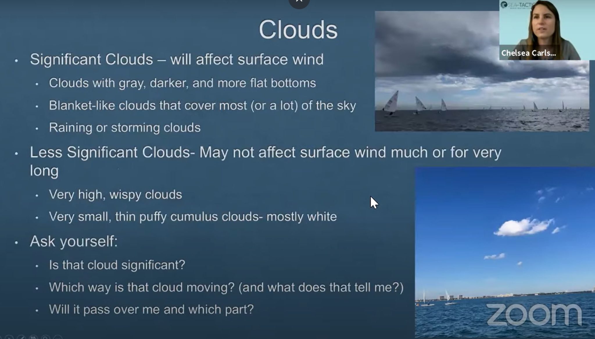
Clouds impact the surface wind more when they are:
- Low
- Vertically developed
- Dark
- Rainy
- Flat bottom
- Densely-packed (more coverage of the sailing area)
Cloud Downdrafts at the Surface
At 00:37:59, she discusses how cumulus and rainy clouds form their own circulation and impact the surface wind.
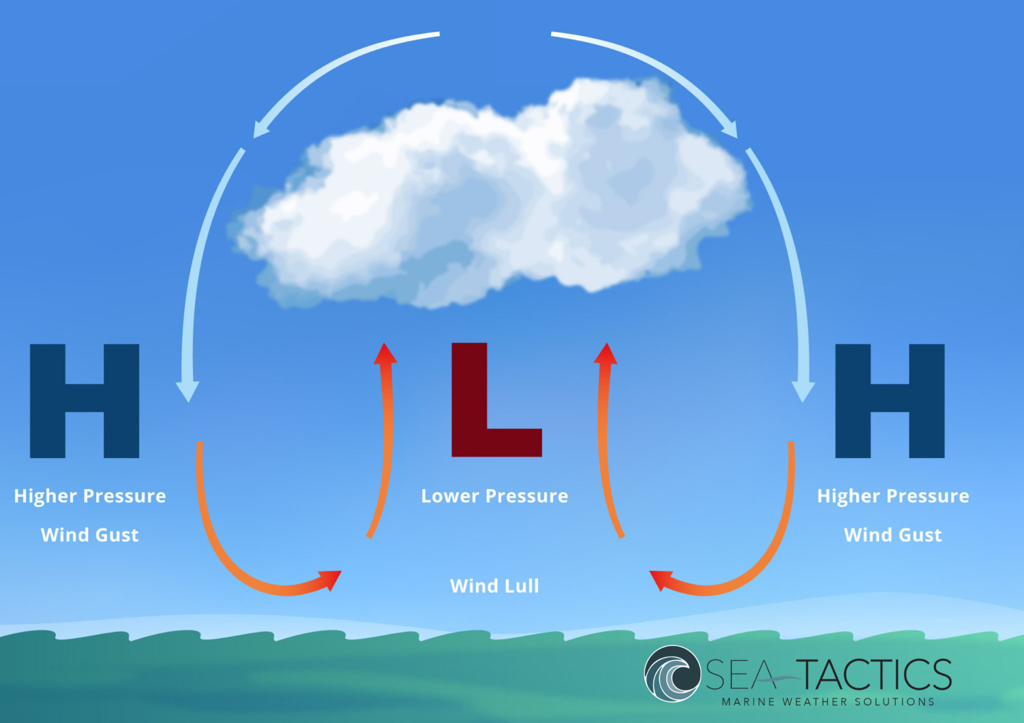
Two key points:
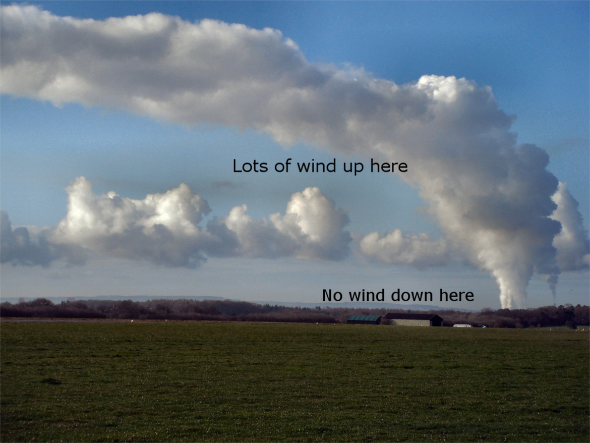
- There is always less wind directly under the clouds, so don’t sail under them. The decrease in wind is due to:
- an updraft under the cumulus clouds
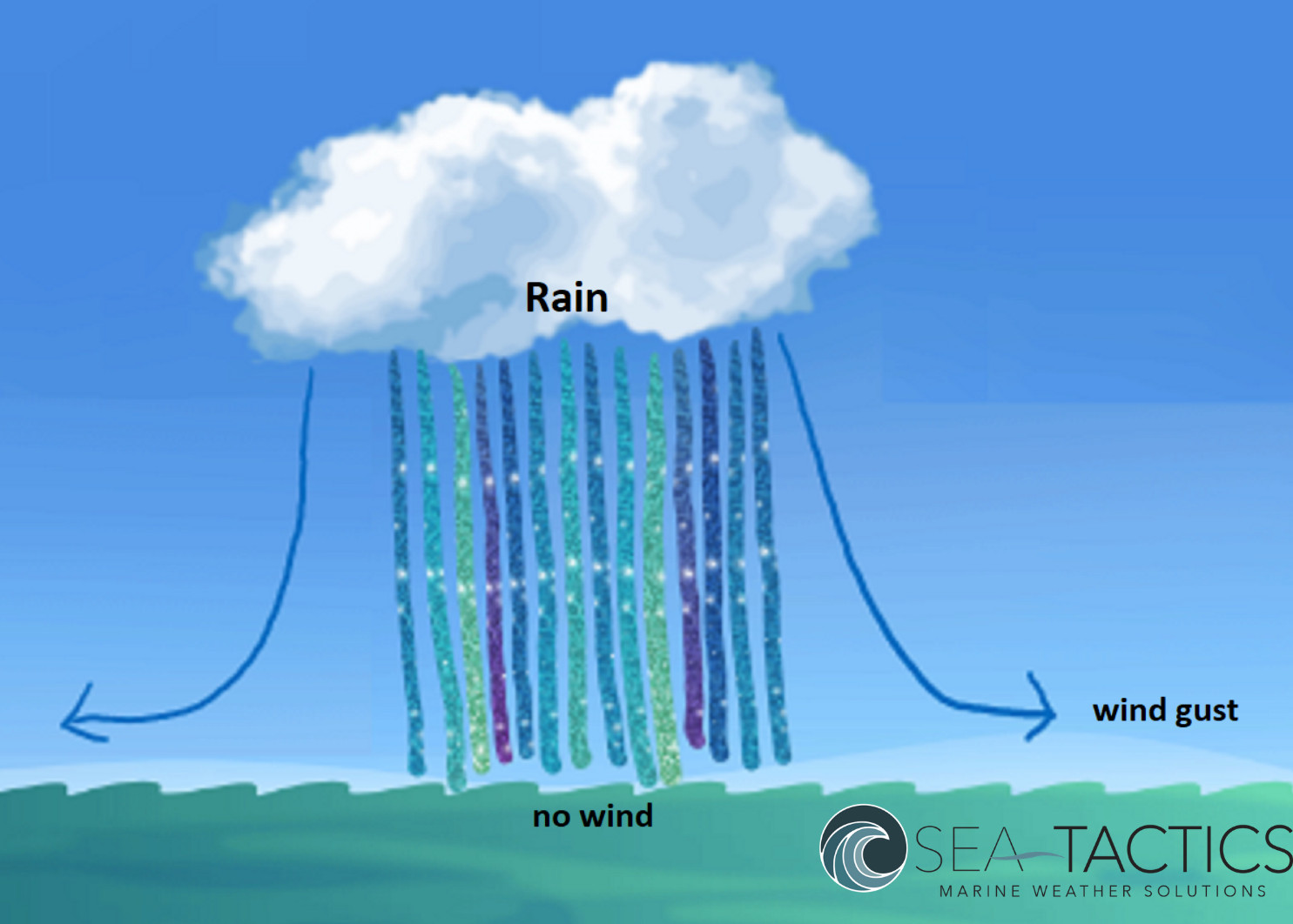
- the falling rain suppressing the wind under rain clouds.
- The cloud-induced downdraft is at the edge of the cloud, flowing into the cloud (non-rainy clouds) or away from the cloud (rainy clouds).
Take the quiz on cloud significance at the end of this video section (00:40:52).
Cloud Wind Plus Surface Wind
As clouds move down the course, their downdrafts combine with the wind moving the cloud. The downdrafts increase, decrease, or change the direction of the surface wind in a predictable way. See the diagram below.
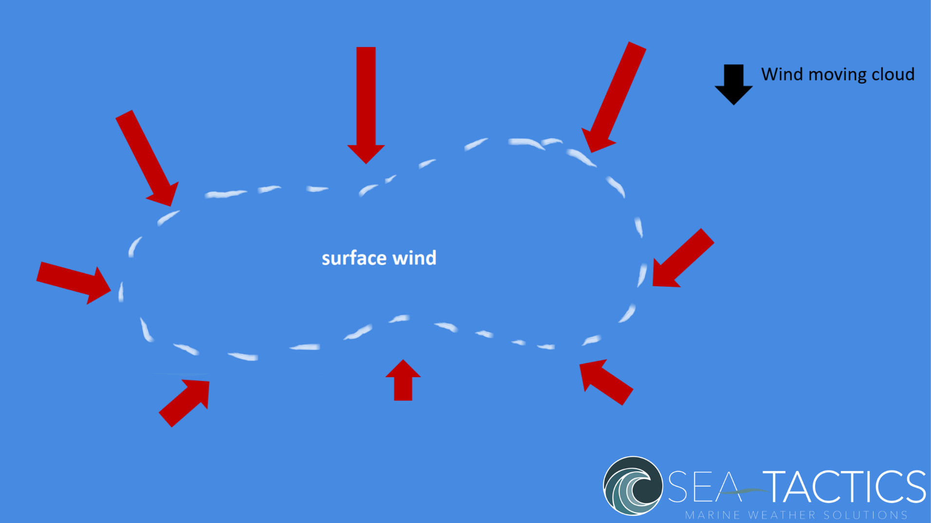
This diagram shows a cumulus cloud moving down the course.
- The black arrow shows the existing wind that’s pushing the cloud along. We’ll assume this arrow shows the wind that would be present at the surface if the cloud didn’t exist.
- The red arrows show the combined effect of the existing wind (black arrow) and the downdrafts around the edges of the cloud. Remember that for a cumulus cloud these downdrafts flow in toward the center of the cloud at the surface.
- As you can see, the combined wind at the surface is stronger “behind” the cumulus cloud, where the downdrafts add to the existing wind. In front of the cloud, the downdrafts oppose the existing wind. Thus, the combined wind is weaker and may be reversed in front of the cloud, depending on the relative strength of the existing wind and the downdrafts.
- Also, the downdrafts change the direction of the wind on each side of the cloud. Looking upwind, there’s a “lefty” on the left side side of the cloud and a “righty” on the right side of the cloud.
If the clouds are significant, watch their path and plan to be in the right place at the right time to take advantage of these effects.
Remember that a rainy cloud would produce the opposite effects of a cumulus cloud. In a rainy cloud, the wind would be stronger in front of the cloud as it moves, and weaker behind it.
Cloud Strategy – Pick a Side
You can also use clouds to help you determine strategy before the start. At 00:54:14 Chelsea gets audience responses and gives the answer to the initial question about picking a side.
We won’t give the answer here, but here’s a hint. The best side of the course is where you can play the leading edges of the cumulus clouds, while avoiding sailing under them.
About Sea Tactics
Chelsea formed Sea Tactics in 2019 to respond to the need for practical weather education in the sailing world. Sea Tactics offers interactive online weather classes, weather coaching, and race forecasting.
To get acquainted with Sea Tactics, browse the website, visit their Facebook page, and enroll for their free weather resource library.
Special offer: Sea Tactics is offering SailZing readers a $50 discount to the February online Coastal Racing course. Sign up and enter the code clouds50.
Speed and Smarts Issue 151 – much more on weather basics (issue available to subscribers)
SailZing Wind Category
Wind Strategy – by David Houghton and Fiona Campbell – the best book on wind for sailors. Also see our review of this book.